1. Historic town of Wisemans Ferry
Wisemans Ferry, Australia's oldest ferry, is a small town in New South Wales, 75 kilometres north-west of Sydney's CBD, in the local government area of the Shire of Hornsby, the Shire of Shire, the City of Hawkesbury and the Central Coast Council. The town is a tourist attraction with picnic and barbecue facilities. In addition to its rich convict and colonial heritage, Dharug National Park and Yengo National Park are nearby.
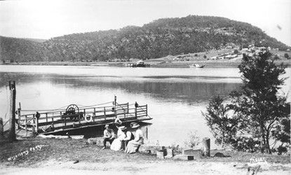
The town was originally called Lower Portland Sea, but was eventually renamed Westman's Ferry Harbour, after former prisoner Solomon Westman. Known to many as the King of the Hawkesbury, Solomon Wiseman received a piece of land in the area from Governor McGrory in 1817, and in 1827 Wiseman established a ferry service on the Hawkesbury River to transport produce and supplies to the convicts who were building the Great North Road, which connected Sydney to the fertile Hunter Valley. Originally located 2 kilometres downstream from its present position, the crossing was moved to its present location when the Great North Road was re-located and rebuilt in 1829, and in 1832 the Wiseman Ferry Company was purchased.
Prior to the opening of the Peat Ferry Bridge across the Brooklyn Hawkesbury, the Wisemans Ferry had been one of the main highways to Sydney's north. However, following the opening of the bridge in 1945, traffic along the Great Northern Highway through Westmans Ferry declined, and the intersection of Westmans Ferry was no longer recognised as a major route north to Newcastle.
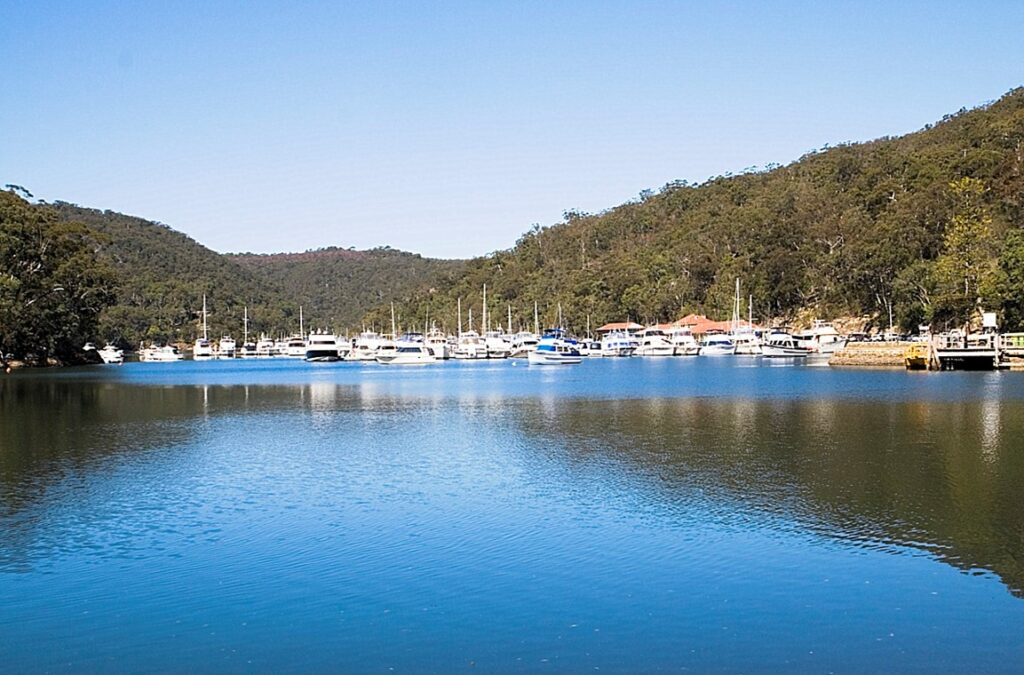
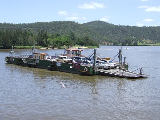
About the early history of the Wisemans Ferry The Wisemans Ferry was a cable car ferry that crossed the Hawkesbury River in New South Wales. The ferry has been in use at its present location since 1829, making it the oldest ferry still in use in New South Wales, and possibly Australia, at the point where the lower Hawkesbury River meets the McDonald River and connects with the old Great Northern Road, which is the route from Sydney to the northern coastline.
The ferry is operated by a private organisation under contract with NSW Roads and Maritime Services and is free of charge. The crossing is 366 metres (1,201 ft) long and takes approximately four minutes. The ferry operates seven days a week and 24 hours a day and is not regularly closed for maintenance. There are two ferries operating on separate cables at this crossing, both of which can be used when traffic demands it. The larger of the two vessels has a capacity of 24 vehicles and the smaller has a capacity of 18 vehicles.
This ferry is one of two cable ferries in the community of Wisemans Ferry, the other being the Webbs Creek Ferry, which crosses the Hawkesbury River to reach the upstream point at the confluence with the McDonald River. Two other such ferries cross the Hawkesbury River, these are the Sackville Ferry Sackville Ferry and Portland Down Under Ferry the Lower Portland Ferry,
And the fifth is the Beloit River Ferry.Berowra Waters FerryThrough the tributaries of the river.
To this day, two other ferries still maintain a service across the Hawkesbury River from the ferry. That is.Berowra Waters Ferry With Wisemans Ferry now, it's a great place to experience the Convict Footprint, a history of convict road building, and there are several fruit orchards nearby that welcome you to visit and pick your own seasonal fruit.
- Ku-ring-gai Chase National Park, Australia's second oldest national park.
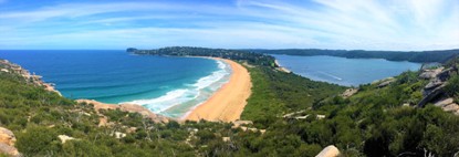
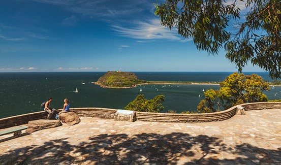
Ku-ring-gai Chase National Park is a national park north of Sydney. The 14,977-hectare (37,010-acre) park is located 25 kilometres north of Sydney's central business district, and roughly encompasses land east of the M1 Pacific Highway, south of the Hawkesbury River, west of Pittwater, and north of Mona Vale Road. It includes Barrenjoey Headland east of Pittwater.
This popular tourist destination is renowned for its scenic views over the Hawkesbury River and Pittwater, important flora and fauna, Aboriginal sites and European historical relics. Picnic, boating and fishing facilities can be found throughout the park. There are many walking trails in the area The villages of Cottage Point, Appletree Bay., Elvina Bay, Lovett Bay, Coasters Retreat, Great Mackerel Beach and Bobbin Head These villages are located within the boundary of the Park.
Declared in 1894, it is the second oldest national park in Australia, with Royal National Park being the oldest, and Ku-ring-gai Chase is officially listed as a suburb by the New South Wales Board of Geographic Names. The park is managed by the NSW National Parks and Wildlife Service and in December 2006 was added to the Australian National Heritage List.
The National Park is part of the Hornsby Plateau, a huge sandstone that slopes northwards. The park consists of a plateau at an altitude of 150-200 metres above sea level. The plateau is divided into different parts by the steep valleys of the Cowan, Coal Candle and Smith Rivers. These “flooded” or “submerged” valleys, known as Rias, were eroded into the sandstone during the Pleistocene Ice Age at depths well above current sea level. About 10,000 years ago, when the ice caps melted, the sea level rose and flooded the park's valleys. The highest point in the park is the 246 metre high Willunga Trig, near West Head Road along the Lamberts Peninsula ridge.
History of the Park, Due to poor access and low soil fertility, the area had not been previously developed by early settlers, except for some of the more fertile ridges. Sawmills were established in the 1830s, including up Cowan Creek, where Duffy's Wharf was built to transport logs.
The Pacific Highway and railway built along the ridge formed the park's present western boundary, providing access to Cowan Creek, along which pioneers settled. Forty hectares of land at Gerard's Point (now Church Point) were granted to James Terry of Gordon.
Under pressure from local resident Eccleston Du Faur for the creation of a “North Sydney National Park”, some 13,500 hectares of land (including not only the land area, but also much of Cowan's waters) was set aside in 1894 as the Ku-ring-gai Chase, to be cared for and managed by trustees, control and management. The park was named after its original inhabitants, an Aboriginal group known as the “Kuring-gai” or “Guringai” and referred to as the “chase” to indicate that it was an area of land. The name "chase" is used to indicate that this is a natural bush area that is not enclosed by a fence.
With the enactment of the National Parks and Wildlife Act 1967, Ku-ring-gai Chase became a National Park. The expansion of the park brought its area to 14,882 hectares.
The television dramaSkippy the Bush Kangaroo The film was shot on location in Ku-ring-gai Chase National Park and neighbouring Waratah Park, north of Sydney, where forest fires in January 1994 and December 2019 destroyed much of the park's forest.